
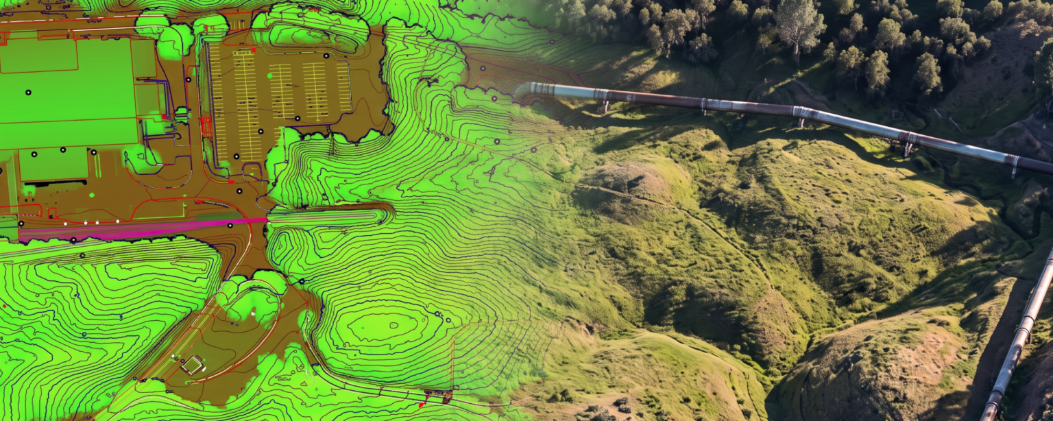
Today’s construction projects generate increasingly large amounts of data — from BIM models and technical drawings to information collected directly on site. However, in an industry where accuracy is essential, having more data is not enough. We need accurate data about what actually exists in reality.
This is where Reality Capture comes in. Through technologies such as LiDAR and 3D scanning, the physical environment can be captured and transformed into precise digital data, which can then be integrated into BIM and GIS workflows or used as a foundation for developing Digital Twins.
From documenting existing conditions and monitoring construction sites to Scan-to-BIM and progress analysis, LiDAR in construction helps move the industry from traditional surveying methods towards a faster, more accurate, and more connected way of working. This is an important step towards data-driven digital construction based on real-world data.
What Is LiDAR?
LiDAR stands for Light Detection and Ranging, a scanning technology that uses laser pulses to measure the distance between the sensor and surrounding surfaces. By rapidly emitting and receiving these pulses, LiDAR systems can collect millions of measurements and build a highly detailed three-dimensional representation of a space, terrain, or object.
In construction, LiDAR is used to accurately capture the real-world conditions of a project — from buildings and infrastructure to sites and terrain. The resulting data can be used for as-built documentation, surveying, progress monitoring, deviation detection, and the development of BIM models.
Unlike traditional measurement methods, 3D scanning enables the rapid capture of a large volume of information about the geometry of a space. The result is a three-dimensional dataset that can be processed and integrated into the project’s digital workflows.
How Does LiDAR Scanning Work?
The process can be simplified as follows:

The LiDAR sensor emits laser pulses towards surrounding surfaces and measures the time it takes for them to return to the sensor. By repeating this process millions of times, the system collects a very large number of points positioned in three-dimensional space.
These points form what is known as a point cloud — a digital representation of the real-world geometry of the scanned environment. Depending on the project’s purpose, the point cloud can then be processed, analysed, and used to generate 3D models, integrate into BIM, or support other Reality Capture applications.
LiDAR, Laser Scanning, 3D Scanning, and Point Cloud: What Is the Difference?
The terms are often used together, but they are not identical:
- LiDAR – a technology that uses laser pulses to measure distances and capture the surrounding environment.
- Laser scanning – the process of scanning a space or object using a laser scanner. LiDAR is one of the technologies used for this type of data capture.
- 3D scanning – a broader term for the process of capturing the geometry of an object or space in three dimensions, using technologies such as LiDAR, laser scanning, or photogrammetry.
- Point cloud – the digital output of the scanning process: millions of points that describe the position and geometry of the captured surfaces.
In a construction project, these technologies are not the end goal, but the starting point for transforming physical reality into usable digital data. From there, the workflow can extend into BIM, GIS, project analysis, and, in more complex projects, Digital Twins.
What Is Reality Capture in Construction?
Reality Capture is the process of capturing the real-world conditions of a space, site, or asset and transforming them into accurate digital data. In construction, this technology creates a link between the physical environment and the digital models used for design, construction, and operations.
Instead of relying solely on manual measurements, photographs, or drawings that may be incomplete or outdated, project teams can use Reality Capture to obtain an up-to-date digital representation of what actually exists on site.
Depending on the project’s objectives, Reality Capture can involve several technologies:
- LiDAR – uses laser pulses to accurately measure distances and generate point clouds;
- Laser scanning – captures the geometry of a space using a laser scanner and generates detailed 3D data;
- Photogrammetry – uses photographs to reconstruct 3D models and mapping products;
- Aerial scanning using UAVs and drones – enables the rapid capture of large-scale sites and projects.
These technologies can be used separately or together, depending on the type of information required. The resulting data can then be integrated into BIM, GIS, and Digital Twins, giving teams a more accurate and up-to-date view of the built environment.
LiDAR vs. Photogrammetry
Two of the most widely used technologies in Reality Capture are LiDAR and photogrammetry. Although both can be used to generate 3D models, the way they capture information is different.
| LiDAR | Photogrammetry |
| Uses laser pulses | Uses images |
| Produces highly accurate point clouds | Produces 3D models from photographs |
| Well suited for geometry and complex surfaces | Well suited for visual documentation and large areas |
| Can be used in a range of lighting conditions | More dependent on image capture conditions |
Choosing between LiDAR and photogrammetry does not mean choosing one technology as “better” than the other. In many construction projects, the two are complementary: LiDAR can provide highly accurate geometric information, while photogrammetry can add visual context and surface information.
Together, they can transform a construction site, building, or terrain into a set of usable 3D data, providing a foundation for more accurate BIM processes and better-informed decision-making.
From LiDAR to Point Cloud: How Data Becomes Usable
Depending on the equipment and scanning method used, point cloud data can contain:
- Position of each point in 3D space;
- Geometry and shape of the captured surfaces;
- Point density, which influences the level of detail in the representation;
- Laser signal intensity of the reflected signal;
- Colour information, when scanning is combined with RGB imagery.
This information enables the digital analysis of existing conditions and can be used as a basis for measurements, modelling, design verification, or construction progress monitoring.
Point Cloud Data Formats
Depending on the equipment and software used, point clouds can be delivered in different formats. Common formats used in LiDAR and 3D scanning projects include:
- .LAS – a standard format for LiDAR and point cloud data;
- .LAZ – a compressed version of the LAS format, allowing large volumes of data to be managed more efficiently;
- .RCP – a format used in Autodesk ReCap to manage and integrate point clouds into Autodesk workflows.
The format itself, however, is not the end goal. The value of a point cloud comes from its ability to be interpreted, integrated, and used to support decision-making throughout the project.
How Is LiDAR Used in Construction?
In construction, LiDAR and 3D scanning transform the physical environment into a source of data that can be measured, analysed, and compared with the digital project.
From documenting existing conditions to construction site monitoring and volume calculations, Reality Capture data can reduce reliance on manual measurements and provide project teams with a more accurate view of site conditions.
As-Built Documentation
One of the most important applications of LiDAR in construction is documenting the actual conditions of a building or project.
By scanning an existing space, teams can obtain an accurate 3D representation of what has actually been built. This data can be used for as-built documentation, renovations, retrofits, interventions in existing buildings, or updating BIM models.
Scan-to-BIM
Scan-to-BIM is the process of using data captured through 3D scanning as a basis for creating or updating a BIM model.
The workflow can be simplified as follows:

Instead of having the digital model built exclusively from existing drawings, it can be based on data captured directly from the built environment. This is particularly useful for existing buildings, where documentation may be incomplete, outdated, or different from actual site conditions.
Construction Progress Monitoring
LiDAR can also be used for construction progress monitoring.
Scans captured at different points in time can be compared to identify changes occurring on site. Reality Capture data can therefore be compared with the BIM model or planned project stages, giving teams an objective view of construction progress.
Deviation Detection
Another important advantage is the ability to compare what was designed with what was actually built.
By overlaying the point cloud with the BIM model, teams can identify geometric deviations, incorrect positioning, or differences between the digital model and existing conditions.
This type of analysis can help identify issues at an earlier stage and reduce the costs associated with corrective work.
Quantity and Volume Calculations
LiDAR data can also be used for volumetric analysis, particularly for earthworks and infrastructure projects.
Point clouds and resulting 3D models can be used to calculate:
- excavation volumes;
- fill volumes;
- material quantities;
- material stockpiles;
- changes in terrain between two scanning periods.
In this way, 3D scanning is not only a documentation tool, but can also become a source of data for estimates and operational decision-making.
Site Surveying and Topography
For terrain and large-scale areas, LiDAR and 3D aerial scanning enable rapid collection of topographic data.
Drones equipped with LiDAR and high-resolution cameras can cover large areas and generate point clouds, DTM, DSM, and georeferenced orthophotos.
This data can support site planning, infrastructure design, construction site monitoring, and urban development, providing an up-to-date digital representation of the terrain.
LiDAR + BIM: Why the Combination Matters
The value of LiDAR in construction does not come only from the accuracy with which it can capture the geometry of a space. The information becomes truly useful when data captured from the physical environment can be integrated into the project’s digital processes.
This is where BIM (Building Information Modeling) comes in.
LiDAR provides a highly accurate representation of existing reality. A point cloud can show the position, shape, and dimensions of elements within a building or on a construction site.
BIM, however, adds another layer of information. In a BIM model, elements can have properties, relationships, and information relevant to design, construction, and operations.
In short:
LiDAR says: “This is the actual situation.”
BIM adds: “These are the elements, properties, and relationships.”
By combining LiDAR, 3D scanning, and BIM, teams can work from accurate, real-world data when creating or updating a digital model.
This is particularly valuable in renovation, retrofit, or intervention projects involving existing buildings, where available documentation may not always reflect current site conditions.
Integrating Reality Capture data into BIM can contribute to better coordination between teams, earlier identification of deviations, and fewer errors that can occur when design is based on incomplete information.
LiDAR and Digital Twins: The Next Step in Reality Capture
LiDAR and Reality Capture can represent the first step towards a more comprehensive digital representation of a building.
A Digital Twin is not simply a 3D model. It is a digital representation connected to the physical asset, capable of integrating data from multiple sources and supporting monitoring, analysis, and decision-making.
In this context, LiDAR can provide an accurate representation of the asset’s physical geometry, while BIM, IoT, and operational data can add information about its elements and how the asset functions.
The process can be viewed conceptually as follows:

Each stage adds a new layer of information. Scanning captures reality, the point cloud transforms it into 3D data, BIM structures information about the built environment, and the Digital Twin can connect this information with operational and real-time data.
The value emerges when this data is not simply stored, but used for monitoring, analysis, simulation, and decision-making.
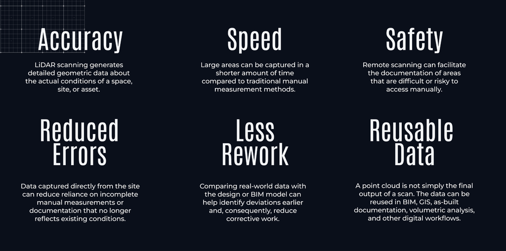
What Are the Benefits of LiDAR for Construction Projects?
Using LiDAR in construction can bring benefits across the design and construction phases, as well as in asset documentation and operations.
When Is LiDAR Worth Using in Construction?
Not every project requires the same level of data capture. The choice of technology should start with the project’s objectives and the type of information required.
LiDAR is particularly relevant when a project involves:
- large areas or extensive sites;
- complex geometry;
- infrastructure projects;
- renovation or transformation of existing buildings;
- high accuracy requirements;
- the need for as-built documentation;
- periodic progress monitoring;
- terrain or material volume calculations;
- integration of data into BIM or GIS.
In these situations, 3D scanning and Reality Capture can transform the measurement process into a reusable source of data throughout the entire project.
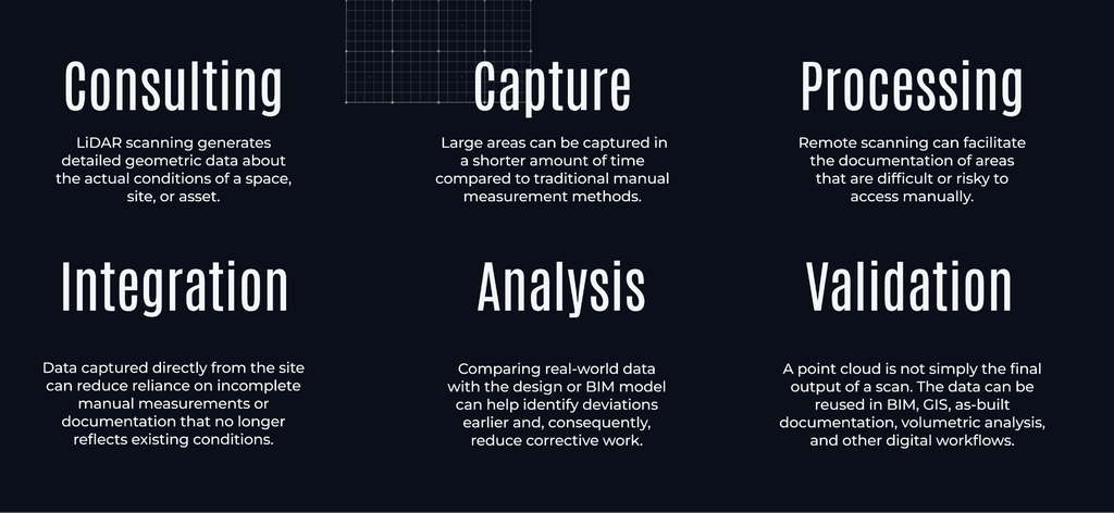
How Does Graphein Integrate LiDAR into the Digital Workflow?
At Graphein, the LiDAR scanning and Reality Capture process is built around the project’s objectives, not just the technology being used.
LiDAR Scan Deliverables
Depending on the project’s objectives and the capture method used, a LiDAR scan can generate several types of deliverables:
- Point clouds – .LAS, .LAZ, .RCP
- Orthophotos
- Georeferenced aerial maps
- DTM (Digital Terrain Model)
- DSM (Digital Surface Model)
- 3D models
- Volumetric analyses
These deliverables can be used independently or integrated into more complex BIM, GIS, and Digital Twin workflows.
The Future of LiDAR in Construction
As the construction industry becomes increasingly data-driven, the role of LiDAR is evolving beyond simple measurement.
Reality Capture can become an important component of a project’s digital infrastructure: physical reality is captured using LiDAR and other 3D scanning technologies, transformed into structured data, integrated into BIM, and then connected with technologies such as AI and Digital Twins.

The direction is clear: it is not just about capturing more data, but about turning accurate data into information that can support better decisions.
The goal is not to collect more data. It is to make better decisions based on accurate data.
FAQ
What is LiDAR in construction?
LiDAR in construction is a 3D scanning technology that uses laser pulses to measure distances and create an accurate digital representation of a building, site, or construction project. The resulting data can be used in BIM, GIS, and other digital workflows.
How is LiDAR used on construction sites?
LiDAR can be used for documenting existing conditions, monitoring progress, checking deviations from the design, 3D measurements, and volume calculations. Scans captured at different stages can be compared to track changes and construction progress.
What is the difference between LiDAR and photogrammetry?
LiDAR uses laser pulses to directly measure distances and generate point clouds, while photogrammetry uses images to reconstruct a 3D model. The two technologies are often complementary and can be used together in Reality Capture projects.
What is a point cloud?
A point cloud is a collection of millions of 3D points that describe the geometry of a space, object, building, or terrain. Each point contains spatial coordinates and, depending on the system used, may also include information such as intensity or colour.
How is a LiDAR scan transformed into a BIM model?
The LiDAR → Point Cloud → BIM workflow begins by capturing the physical environment through scanning. The point cloud is then processed and used as a reference for creating or updating a BIM model, providing a more accurate basis for representing existing conditions.
What is Scan-to-BIM?
Scan-to-BIM is the process of using 3D data captured through LiDAR or other Reality Capture technologies to create or update a BIM (Building Information Modeling) model. It is particularly useful for existing buildings, renovations, retrofits, and as-built documentation.
Can LiDAR be used for Digital Twins?
Yes. LiDAR can provide an accurate geometric representation of a physical asset, which can be integrated with BIM, IoT, and operational data to develop a Digital Twin. The value emerges when this data is used for monitoring, analysis, simulation, and decision-making.
How accurate is LiDAR scanning?
The accuracy of a LiDAR scan depends on the equipment used, the capture method, the distance from the object, site conditions, and data processing. For construction projects, the equipment and scanning method should be selected based on the required level of accuracy and the project’s objectives.